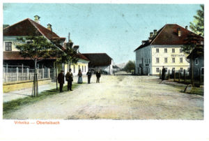
VRHNIKA ON A POSTCARD FROM 1901 (SOURCE: CANKAR’S LIBRARY OF VRHNIKA)

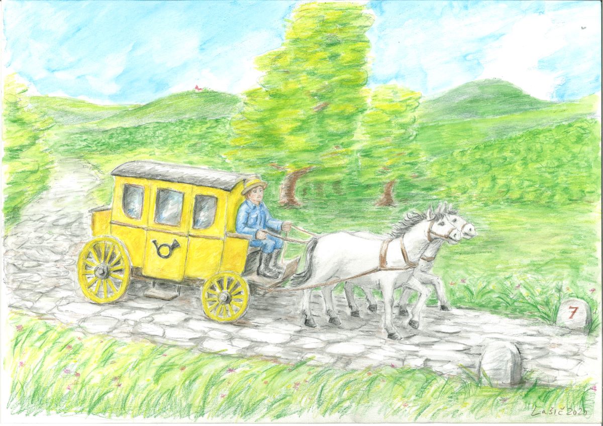
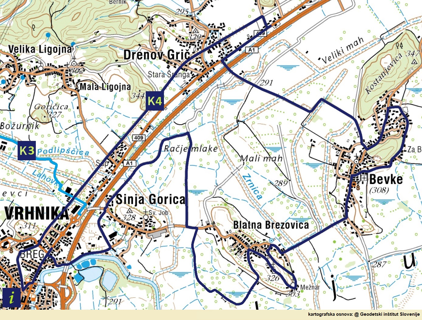
The construction of the second imperial road is being undertaken more professionally, with the participation of civil engineers, miners, military workers and military officers, masons, carpenters, etc. and no longer by pressure. The road is designed so that it does not exceed a slope of 4%, which is supposed to mean that strapping was no longer necessary. Plans for a new road were prepared by the construction director Jožef Šemerl in 1793. The construction of the road began in Planina in 1803, and it took three years to reach Vrhnika for 24 km. Between Vrhnika and Logatec it runs in a completely new direction, the road is macadam, paved with cubes only after the Second World War.

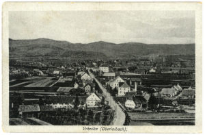
VRHNIKA ON A POSTCARD FROM 1918 (SOURCE: CANKAR’S LIBRARY OF VRHNIKA)

There are two toll booths in operation in Vrhnika at this time, and carriers try to avoid paying tolls by turning from the Imperial Road to Idrijska cesta and the surrounding cart tracks, while road workers prevent evading payment by digging forest paths and digging ditches, by erecting walls along the road. and with high penalties.

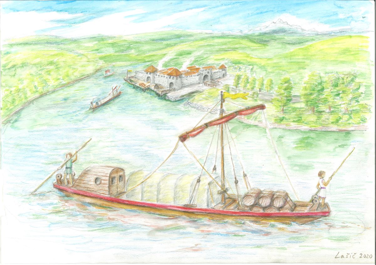
The new road leading from Vienna to Trieste is a wide and flat enough road to transport cargo with the same large carriage with several pairs of horses all the way, so the volume of truck-related activities is greatly reduced, and workers in the port lose their jobs. only bricks and wood are loaded on the Ljubljanica.

Interesting:

Even before the new road was finally arranged, Napoleon’s soldiers descended from Planina on 19 May 1809. They don’t leave a very good impression after four years, as they steal everything they can get their hands on.


Attila the Hun, he ruler of the Huns from 434 until his death in March 453.

The Roman roads between Emona and Aquileia are deteriorating uncontrollably and the cargo between Vrhnika and Ljubljana is beginning to be redirected to the Ljubljanica. In Vrhnika, they transfer cargo from ships or boats to horse backs (and vice versa) and load it towards Trieste. Milling is also booming, as a load of flour is more expensive than a load of grain and it is easier to bear the high costs of loading over long distances.

With the development of carting, other activities are also developing, such as blacksmithing and animal husbandry, wheel making and saddlery. Merchants and innkeepers serve by renting sheds for harvesting goods, barns for livestock, haylofts, lodgings for trucks and food. The inn business is mainly run by large farmers, but also by the pastor and market dignitaries, as well as the mayor, postman and judge. Inns are the center of events in every place, including Vrhnika, where news and stories are exchanged, and they are often the place where diseases are transmitted.

Mail carriage (academic sculpturer Jože Lašič)

Cart-making becomes a lucrative business, but lords face many dangers, the biggest of which are bandits, so they join larger caravans on the way. The most dangerous section to Trieste is the pass between Planina and Postojna, which has retained the sinister name Ravbarkomanda (bandit-control-point)) to this day.

BY THE END OF XIX. CENTURY VRHNIKA IS DIVIDED INTO THREE INDEPENDENT SETTLEMENT CORE – BREG, HRIB AND VAS. VRHNIKA STATUS OF THE PLACE IN 1955

Interesting:

In 1719 Emperor Charles VI. orders the renovation of a narrow old road that ran from the port of Breg, across the village and Hrib. Renovations are being undertaken very unprofessionally, so the new slopes are steep 20% and more. Due to the steep slopes, a new market niche opens up for the people of Vrhnika – strapping and lending horses on ascents and gliding (braking) on steep descents.


The port of Vrhnika-Breg (J. V. Valvasor, 1689, copper engraving)

The Ljubljanica is not a large river, its entire course measures only 43 km, but it has been the most remarkable waterway in Carniola since ancient times. Valvazor also writes about boating – the Ljubljanica is full of boats that transport all kinds of goods that come from Italy and are sent to Italy. Written sources mention the year 1489, when Emperor Frederick granted large boatmen a special privilege – the freedom to sail on the Ljubljanica.

Goods are transported in small and large boats. With small boats hollowed out of a single trunk, they carry up to 30 cents (1680 kg) of cargo. With about seven meters long boatmen or roofers (boats with a roof) they transport people, and with an even longer sandblaster they transport sand. Large boats are up to 20 meters long and carry up to 300 cents (almost 17 tons) of cargo.

SAILING IN LJUBLJNICA RIVER (J. V. VALVASOR, 1689, COPPER ENGRAVING)

Two ports are being built in Vrhnika, for passengers it is being built at the former post office, toll booth and inn – Lavrenčič’s house – near the bridge to Verd, and a cargo port opposite the former Roman port. Traffic on the Ljubljanica declined considerably after the construction of the Imperial Road in 1728, after the construction of the road in 1809 only wood and bricks were transported from Vrhnika to Ljubljana, and after the construction of the Southern Railway (1858) traffic on the Ljubljanica completely died out.

Interesting:

Eminent travelers, such as the emperors Leopold I (1660), Charles VI (1728) and Franz I (1821) also arrived from Ljubljana to Vrhnika by the Ljubljanica river.


Roman ship with Nauportus in the background (academic sculptor Jože Lašič)

Evidence shows that after the last glaciation, the Ljubljana Marshes covered the lake. This shrank over the millennia and in the middle of the 2nd millennium BC only a large swampy plain remains, through which the Ljubljanica winds lazily.

JAZON SHOULD BE ARRIVED BY THE SHIP NAMED ARGO TO THE SOURCE OF THE LJUBLJANICA IN THE MOČILNIK AROUND 1222

According to legend, the Ljubljanica was navigable as early as the 2nd millennium BC, as the Argonauts were supposed to sail along it from the Black Sea across the Danube and the Sava all the way to Vrhnika. As a navigable river, it gained importance with the arrival of the Romans in the middle of the first century BC, when they built the settlement of Navport, intended for the transshipment mainly of military equipment for the Roman legions, which penetrated towards the Danube, from wagons to river ships. Numerous finds also testify to this. As early as 1890, a Roman cargo ship from the first century BC was discovered near Črna vas and in 2008 in Sinja gorica another one, the specialty of which is the technique of joining with iron couplings, which is a missing link in research into the technology of construction of the Mediterranean type of vessels and the development of shipbuilding in general. With the completion of the occupation phase of the Roman legion in Pannonia and the construction of the Navport-Emona road, the importance of the waterway for the Roman army diminished but did not die out.

RECENTLY DISCOVERED ONE OF THE LARGER LOGBOAT FROM II. CENTURY BC INDICATES THAT TAURISCI WERE ALREADY SAILING ON LJUBLJANICA AT THAT TIME

Interesting:

As the Greek writer Strabo mentions, it was already in the middle of the 2nd century BC in the wider area of Vrhnika there was a settlement called Nauportus (Nauportus – navis, portus – port) in a Latin form.


ON THE ROUTE OF THE FORMER MERCURY ROUTE

Idrija is connected with the river port of Vrhnika around 1508, soon after the discovery of mercury. A narrow road with steep ascents and descents is too dangerous or at least unsuitable for transporting mercury even with small carriages, so heavy and liquid metal is loaded mainly on horseback. Due to the planned visit of Empress Maria Theresa to Idrija, a suitable road for small carriages was built only between 1760 and 1763, but the visit did not take place, as the Empress died earlier.

Maria Theresa (1717–1780) was the only female ruler of the Habsburg dominions, ruling from 1740 until her death in 1780. She was the sovereign of Austria, Hungary, Croatia, Bohemia, Transylvania, Mantua, Milan, Lodomeria and Galicia, the Austrian Netherlands and Parma. With the imperial coronation of her husband France I, Stephen of Lorraine, she was Duchess of Lorraine, Grand Duchess of Tuscany and Holy Roman Empress.

RULER MARIA THERESA AS A WIDOW (PTUJ PROVINCIAL ARCHIVE, OIL PAINTING BY ANTON VON MARON, 1772)

In her marriage to France I, Stephen of Lorraine, she has as many as sixteen children, eleven of them girls, ten with the name Maria, the youngest of whom is better known by the French name Marie Antoinette. Maria Theresa begins to reform the army, double the number of men in the Austrian army and reform the tax system to provide regular revenues for the maintenance of the government and the army, centralize the government by merging the previously separate Austrian and Czech chancelleries into one administrative office, establish a supreme court the task is to maintain the law in her lands and to strengthen the economy in the empire through reforms.

Interesting:

The Empress is working hard to eradicate hunger, so she requires farmers to grow potatoes. As the peasants resist, Maria Theresa sends soldiers to guard the fields planted with potatoes. These soldiers are told they have potatoes, as guarding the fields in those days is certainly inappropriately less dangerous than fighting an enemy army.


The road connecting Idrija with Vrhnika was built around 1508, soon after the discovery of mercury (1493), and until 1721 it was the only road connection from Idrija. It is intended to supply the mine with timber, equipment, food and the transport of mercury ore to the world. It is taken from the Gewerkenegg castle in Idrija across Kovačev Rovt to Zaplana and Vrhnika. Oral tradition says that soon after the start of mining in Idrija, the chaplain from Rovte measured the length of 13,994 Idrija klafters. This measure of length (klaftra) was used in a mercury mine and is the height of one wooden cave support or about 1.6 meters. It is also used by the architect Podrecca in the arrangement of the town square in Idrija. When the Southern Railway is built with a station in Logatec, the transport of mercury on horseback on this road almost dies.

Maria Theresa, ruler of the Habsburg lands

The Mecury


The mercury warehouse (16th century)

For the needs of storing mercury before transporting it along the Ljubljanica to Ljubljana, opposite the former cargo port of Nauportus, a warehouse was built in 1510, an eleven-axis two-storey building with a symmetrical gable, with stone frames, wrought iron nets and wooden porticoes. Mercury storage and transport along the Ljubljanica lost its significance when the Southern Railway from Vienna to Trieste was built and the role of a transshipment station was taken over by Logatec, which was not bypassed by the railway.

Interesting:

Mercury is loaded and stored in tightly closed iron containers in the form of bottles called cylinders.


The Idrija mercury mine was one of the world’s largest producers of mercury and cinnabar (end of production in 1995), surpassed only by the Spanish Almadén mine (end of production in 2003). The majority of the population in Idrija made a living from mining from generation to generation. For five hundred years, Idrija miners burned mercury ore at high temperatures so that mercury would evaporate from it and liquefy it again in the cold. In ores it mostly appears as cinnabarite or as native mercury.

THE ANTHONY’S TRENCH IS THE OLDEST PRESERVED ENTRY INTO THE MERCURY MINE IN IDRIJA AND ONE OF THE OLDEST IN EUROPE. IT IS NAMED AFTER ST. ANTON PADOVANSKI, CAVE PROTECTOR AND PROTECTOR AGAINST ACCIDENTS. SINCE 1994, IT HAS BEEN ARRANGED FOR TOURS (SOURCE: CUDHG IDRIJA).

The only liquid metal – mercury is extremely harmful and in the form of organic compounds also toxic. This is why it has been replaced in the industry by other substances. Mercury was and still is used in some places today for the production of industrial chemicals, in electronic devices, in telescopes, as well as in energy-saving light bulbs, as it is a good conductor of electricity. It dissolves gold, zinc, aluminum and other metals and forms amalgams (lat. Alloys with mercury).

EXCAVATED TRECHES WERE FORTIFIED WITH WOOD FROM THE SURROUNDING HILLS (SOURCE: CUDHG IDRIJA)

The mercury trade was just as important as its production. Various European merchants became rich with it, and after 1659 the mercury trade was taken over by the Viennese court chamber.

The Heritage of Mercury was inscribed on the UNESCO World Heritage List in 2012.

Interesting:

Mercury is the only metal that is in a liquid state at normal temperature and pressure.


The cycling route “History of traffic in Vrhniško” is a circular cycling and walking route, 23 km long (the route on Bikemap) and almost completely flat (“we are surprised by only two shorter and steep slopes in Blatna Brezovica), of which 13.7 km macadam roads or cart tracks. It is suitable for families and for all types of bicycles, but it should be borne in mind that half of the route is on macadam paths and cart tracks and thus less suitable for road bikes. The trail is a joint project of five local communities along which the trail runs – Bevke (4.6 km), Blatna Brezovica (5.1 km), Drenov Grič (4.7 km), Sinja Gorica (3.0 km) and Vrhnika-Breg (5.1 km).

The bike path is dedicated to five millennia of means of transport and transport routes, from the oldest discovered bicycle (5,200 years old) in the world along the Ljubljanica at Stare gmajne near Verd, to the first, 32 km long section of the motorway in Slovenia and former Yugoslavia between Vrhnika and Postojna.

The official beginning and the end of the route is the railway station (at the Agricultural Cooperative or the former Simon Inn) of the last section of the now abandoned railway for decades, which until 1966 connected Vrhnika with Ljubljana. Almost to the border with the municipality of Log-Dragomer, the route runs along the former railway route. It turns onto the bike path along Ljubljanska cesta between Felix Trans and the Top Dom Obnova store. On the main road, turn left to the first traffic light, cross the road here and head towards Vrhnika on the other side, then cross the main road to Drenov Grič twice more, the second time when we turn along the new asphalt road towards Bevke. Continue reading


In the project Network of cycling routes in the municipality of Vrhnika or The Green Valley of Saint Florian – the municipality addresses only one segment of the tourist infrastructure, cycling routes in Vrhnika with some extentions to neighboring municipalities. In the period 2020–2022, we do not plan the construction of additional cycling infrastructures, such as bicycle rentals, bicycle services, showers and locker rooms, while accommodation facilities are subject of other projects. In any case, the routes will come to life only when we have daily at least 500 tourists in Vrhnika and we will be able to keep them in the hotel for more than just for a late dinner, overnight stay and early breakfast. We took as a starting point the conceptual project of the “Lista za razvoj Vrhnike in podeželja” (List for the development of Vrhnika and rural areas) “Ten kilometers of new bike paths per year – seven to ten year project of the municipality of Vrhnika”.

LOKALNA KOLESARSKA MREŽA

Continue reading


Vrhnika lies at the junction of the moor and the Dinaric Alps, right where the easiest and most laid passage from the Ljubljana Basin to the Adriatic Sea and northern Italy. The suitability of the terrain for settlement and the possibility of crossing have contributed to the fact that traffic with various means of transport has been going on here for more than 5,000 years. Legends and material evidence tell us that this area has been (occasionally) inhabited for over 40,000 years.

Pile dwellers ARE THE FIRST TO LEAVE MORE TRACE IN OUR TERRITORY

Excavations show that caravan and trade routes took place here in antiquity, the legendary Jason is said to have carried the ship Argo with the Argonauts, amber has been loaded from the Baltic to Aquileia for over a thousand years, and the right road, the via Gemina, was built by the Romans from Aquileia to Nauportus. in the middle of the 1st century. B.C..

Half a century later, they built a shorter road across Hrušica (Ad Pirum) to Emona, while draining the bogs and shortening the course of the Ljubljanica by almost half. After the fall of the Roman Empire, Barje became swampy again, and the roads disintegrated or became overgrown, so they sailed on the Ljubljanica for many years. When Trieste gained the status of a free city (1719), the traffic between Vienna and Trieste increased so much that the Austrian Empire first built a real imperial road (1809) and then the Southern Railway (opened in 1857). In recent history, the area between Vrhnika and Postojna was given the first motorway in the former Yugoslavia in 1972.

INTERESTING:

From east to west, the Celts (III-II century), the Eastern Goths with Theodoric the Great (beginning of the 5th century), the Huns with Attila at the head (5th century), the Lombards with the legendary King Albion and Saxons, Gepids, Bavarians, Obri and Slavs (VI century), from west to east the area was crossed by Roman soldiers (around year zero), the Franks with Charlemagne (at the end of the IX century), Napoleon’s French .Stol.) And the Italians in World War II.