About potepinko

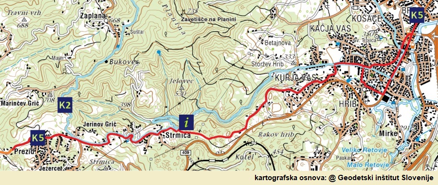
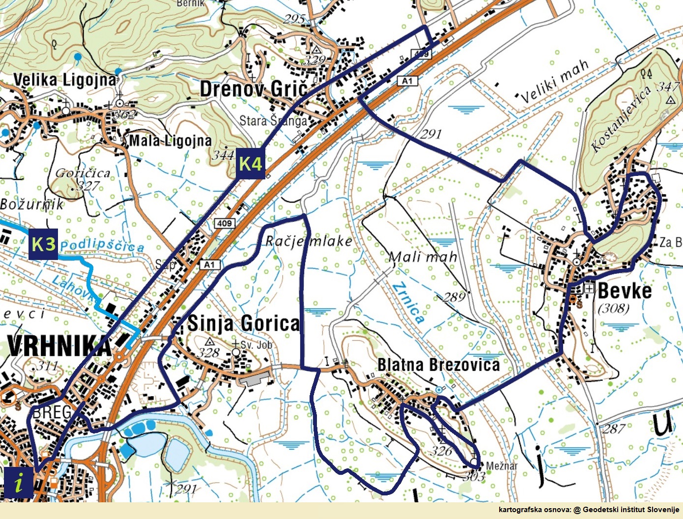
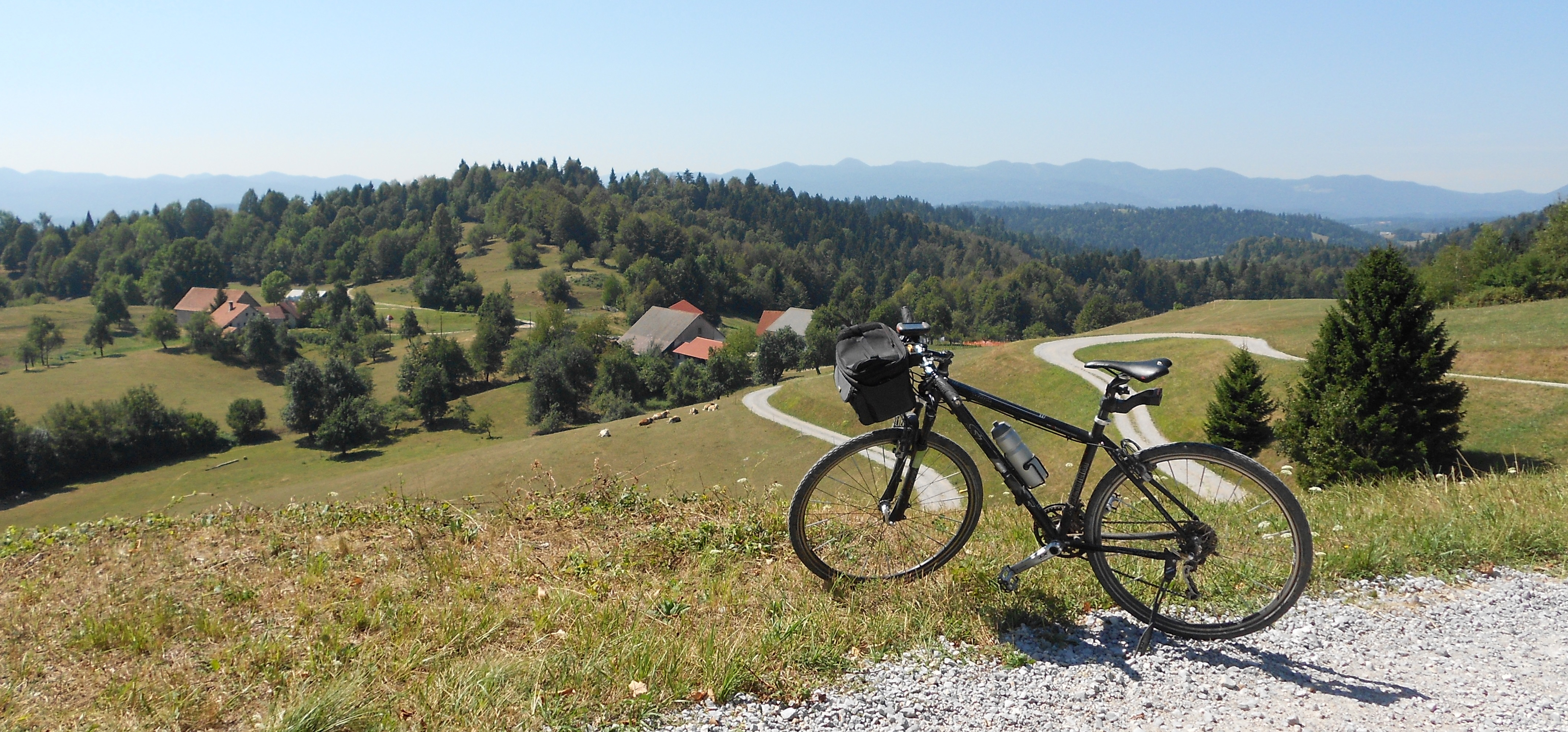
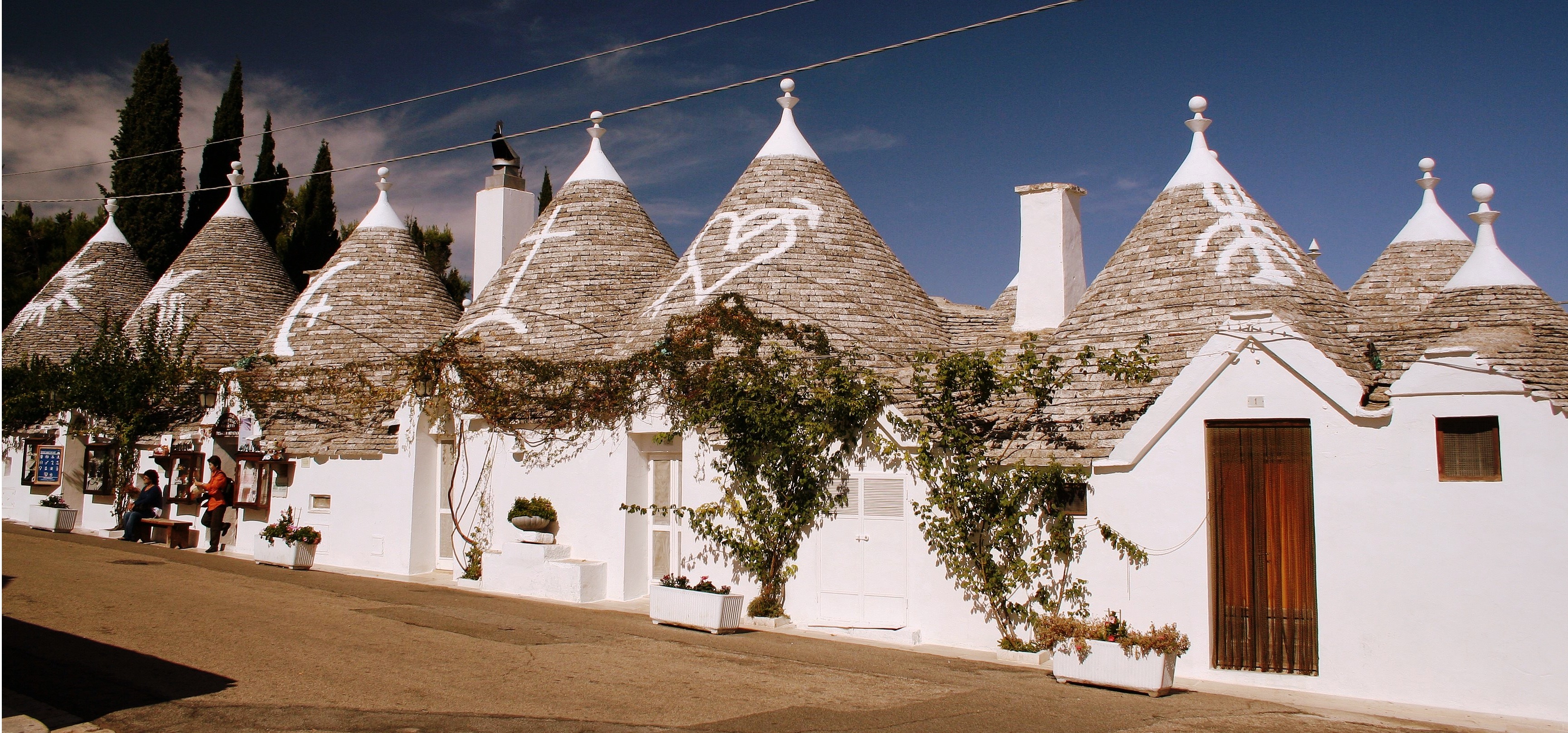
ON THE ROUTE OF THE FORMER MERCURY ROUTE

Idrija is connected with the river port of Vrhnika around 1508, soon after the discovery of mercury. A narrow road with steep ascents and descents is too dangerous or at least unsuitable for transporting mercury even with small carriages, so heavy and liquid metal is loaded mainly on horseback. Due to the planned visit of Empress Maria Theresa to Idrija, a suitable road for small carriages was built only between 1760 and 1763, but the visit did not take place, as the Empress died earlier.

Maria Theresa (1717–1780) was the only female ruler of the Habsburg dominions, ruling from 1740 until her death in 1780. She was the sovereign of Austria, Hungary, Croatia, Bohemia, Transylvania, Mantua, Milan, Lodomeria and Galicia, the Austrian Netherlands and Parma. With the imperial coronation of her husband France I, Stephen of Lorraine, she was Duchess of Lorraine, Grand Duchess of Tuscany and Holy Roman Empress.

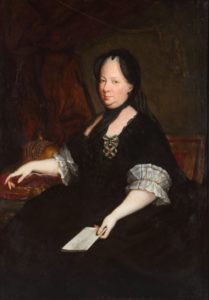
RULER MARIA THERESA AS A WIDOW (PTUJ PROVINCIAL ARCHIVE, OIL PAINTING BY ANTON VON MARON, 1772)

In her marriage to France I, Stephen of Lorraine, she has as many as sixteen children, eleven of them girls, ten with the name Maria, the youngest of whom is better known by the French name Marie Antoinette. Maria Theresa begins to reform the army, double the number of men in the Austrian army and reform the tax system to provide regular revenues for the maintenance of the government and the army, centralize the government by merging the previously separate Austrian and Czech chancelleries into one administrative office, establish a supreme court the task is to maintain the law in her lands and to strengthen the economy in the empire through reforms.

Interesting:

The Empress is working hard to eradicate hunger, so she requires farmers to grow potatoes. As the peasants resist, Maria Theresa sends soldiers to guard the fields planted with potatoes. These soldiers are told they have potatoes, as guarding the fields in those days is certainly inappropriately less dangerous than fighting an enemy army.


The road connecting Idrija with Vrhnika was built around 1508, soon after the discovery of mercury (1493), and until 1721 it was the only road connection from Idrija. It is intended to supply the mine with timber, equipment, food and the transport of mercury ore to the world. It is taken from the Gewerkenegg castle in Idrija across Kovačev Rovt to Zaplana and Vrhnika. Oral tradition says that soon after the start of mining in Idrija, the chaplain from Rovte measured the length of 13,994 Idrija klafters. This measure of length (klaftra) was used in a mercury mine and is the height of one wooden cave support or about 1.6 meters. It is also used by the architect Podrecca in the arrangement of the town square in Idrija. When the Southern Railway is built with a station in Logatec, the transport of mercury on horseback on this road almost dies.

Maria Theresa, ruler of the Habsburg lands

The Mecury


The mercury warehouse (16th century)

For the needs of storing mercury before transporting it along the Ljubljanica to Ljubljana, opposite the former cargo port of Nauportus, a warehouse was built in 1510, an eleven-axis two-storey building with a symmetrical gable, with stone frames, wrought iron nets and wooden porticoes. Mercury storage and transport along the Ljubljanica lost its significance when the Southern Railway from Vienna to Trieste was built and the role of a transshipment station was taken over by Logatec, which was not bypassed by the railway.

Interesting:

Mercury is loaded and stored in tightly closed iron containers in the form of bottles called cylinders.


The Idrija mercury mine was one of the world’s largest producers of mercury and cinnabar (end of production in 1995), surpassed only by the Spanish Almadén mine (end of production in 2003). The majority of the population in Idrija made a living from mining from generation to generation. For five hundred years, Idrija miners burned mercury ore at high temperatures so that mercury would evaporate from it and liquefy it again in the cold. In ores it mostly appears as cinnabarite or as native mercury.

THE ANTHONY’S TRENCH IS THE OLDEST PRESERVED ENTRY INTO THE MERCURY MINE IN IDRIJA AND ONE OF THE OLDEST IN EUROPE. IT IS NAMED AFTER ST. ANTON PADOVANSKI, CAVE PROTECTOR AND PROTECTOR AGAINST ACCIDENTS. SINCE 1994, IT HAS BEEN ARRANGED FOR TOURS (SOURCE: CUDHG IDRIJA).

The only liquid metal – mercury is extremely harmful and in the form of organic compounds also toxic. This is why it has been replaced in the industry by other substances. Mercury was and still is used in some places today for the production of industrial chemicals, in electronic devices, in telescopes, as well as in energy-saving light bulbs, as it is a good conductor of electricity. It dissolves gold, zinc, aluminum and other metals and forms amalgams (lat. Alloys with mercury).

EXCAVATED TRECHES WERE FORTIFIED WITH WOOD FROM THE SURROUNDING HILLS (SOURCE: CUDHG IDRIJA)

The mercury trade was just as important as its production. Various European merchants became rich with it, and after 1659 the mercury trade was taken over by the Viennese court chamber.

The Heritage of Mercury was inscribed on the UNESCO World Heritage List in 2012.

Interesting:

Mercury is the only metal that is in a liquid state at normal temperature and pressure.


The cycling route “History of traffic in Vrhniško” is a circular cycling and walking route, 23 km long (the route on Bikemap) and almost completely flat (“we are surprised by only two shorter and steep slopes in Blatna Brezovica), of which 13.7 km macadam roads or cart tracks. It is suitable for families and for all types of bicycles, but it should be borne in mind that half of the route is on macadam paths and cart tracks and thus less suitable for road bikes. The trail is a joint project of five local communities along which the trail runs – Bevke (4.6 km), Blatna Brezovica (5.1 km), Drenov Grič (4.7 km), Sinja Gorica (3.0 km) and Vrhnika-Breg (5.1 km).

The bike path is dedicated to five millennia of means of transport and transport routes, from the oldest discovered bicycle (5,200 years old) in the world along the Ljubljanica at Stare gmajne near Verd, to the first, 32 km long section of the motorway in Slovenia and former Yugoslavia between Vrhnika and Postojna.

The official beginning and the end of the route is the railway station (at the Agricultural Cooperative or the former Simon Inn) of the last section of the now abandoned railway for decades, which until 1966 connected Vrhnika with Ljubljana. Almost to the border with the municipality of Log-Dragomer, the route runs along the former railway route. It turns onto the bike path along Ljubljanska cesta between Felix Trans and the Top Dom Obnova store. On the main road, turn left to the first traffic light, cross the road here and head towards Vrhnika on the other side, then cross the main road to Drenov Grič twice more, the second time when we turn along the new asphalt road towards Bevke. Continue reading


SPULICO – GENOVA (BOLOGNA)

Kdo pravi, da nimamo idej? Ideje so, le Corona nam zaenkrat ne da dihati. Eden od predlogov je, poleg »neoddelane« lanske trase po Franciji, da avanturo začnemo v Genovi in kolesarimo po via Postumia in via Gemina do Vrhnike, drugi pa, da začnemo ali končamo v deželi Svete k(o)rone (Apulija) oziroma v njeni sosedi (Bazilikata) – Sacra Corona Unita je sicer prepoznana kot četrta italijanska mafija. Pot bo od Roseta Capo Spulico speljana po sredini Apeninov do Genove (1.350 km, 15 dni kolesarjenja oziroma 90 km dnevno) oziroma do Bologne (1.045 km, 12 dni kolesarjenja oziroma 87 km dnevno) in bo seveda temu primerno razgibana (7.650 v.m. (povprečno 510 v.m. na dan) oziroma 6.810 v.m. (571 v.m./dan)).

SPULICO – GENOVA (BOLOGNA)

Od zanimivejših krajev na poti je treba omeniti (po abc) Amatrice (tu se zaustavimo na špagetih ali bukatinih alla’amatriciana (video)), Anghiari, Castel di Sangro (v Abrucu je gradov veliko), Genova, Isernia, (popotresna) L’Aquila, Montereale, Monte Santa Maria Tiberina, (popotresna) Norcia, Poppi, Potenza, Roseto Capo Spulico (tu si bomo noge namočili v Sredozemskem morju), Santo Stefano d’Aveto, Umbertide, če pa bomo zavili še malo levo ali desno, pa jih lahko najdemo še precej več. »Obdelali« bomo osem od dvajsetih italijanskih deželAbruce, Bazilikato, Emilijo Romanjo, Kampanijo, Lacij, Ligurijo, Toskano in Umbrijo.

(več o vsemu, ko bo trasa izbrana in/ali bodo razmere dopuščale).


RIMSKE CESTE IN VIA GEMINA

Po pomembnosti se rimske ceste delijo na javne, stranske, krajevne in zasebne ceste. Javne ceste gradijo praviloma čim bolj naravnost, zato ponekod klanci dosegajo tudi 20-odstotni naklon. Manjše ovire na načrtovani trasi poti, npr. gričevje, odstranijo, v večje skalnate vzpetine skopljejo predore, čez reke pa zgradijo mostove, za kar so Rimljani pravi mojstri. Ob cestah v razmiku ene milje (tisoč (dvojnih) korakov ali 1478,5 metra) postavijo okrogle dvometrske miljnike, izdelane iz enega samega kosa kamna. Zlati ničelni miljnik (miliarium aureum), od koder se šteje oddaljenost od Rima, postavijo sredi Foruma. . (več >>>).  

The Roman roads AND VIA GEMINA

According to importance, Roman roads are divided into public, side, local and private roads. As a rule, public roads are built as straight as possible, so in some places the slopes reach 20%. Minor obstacles on the planned route, e.g. hills, are removed, tunnels are dug into larger rocky hills and bridges are built over rivers, for which the Romans are true masters. Along the roads at a distance of one mile (thousand (double) steps or 1,478.5 meters), they place round two-meter high milestones made of a single piece of stone. (more >>>).

STRADE ROMANE E VIA GEMINA

Secondo l’importanza, le strade romane si dividono in strade pubbliche, laterali, locali e private. Di norma, le strade pubbliche sono costruite il più drittamente possibile, quindi in alcuni punti le piste raggiungono una pendenza del 20%. Ostacoli minori sul percorso pianificato, ad es. le colline, vengono rimossi, si scavano gallerie in colline rocciose più grandi e si costruiscono ponti sui fiumi, per i quali i romani sono veri maestri. Lungo le strade a una distanza di un miglio (mille (doppi) gradini o 1.478,5 metri) si collocano pietre miliari rotonde di due metri costituite da un unico pezzo di pietra. Al centro del Foro è posto il miliare zero d’oro (miliarium aureum), da cui si conta la distanza da Roma. (più >>>)


In the project Network of cycling routes in the municipality of Vrhnika or The Green Valley of Saint Florian – the municipality addresses only one segment of the tourist infrastructure, cycling routes in Vrhnika with some extentions to neighboring municipalities. In the period 2020–2022, we do not plan the construction of additional cycling infrastructures, such as bicycle rentals, bicycle services, showers and locker rooms, while accommodation facilities are subject of other projects. In any case, the routes will come to life only when we have daily at least 500 tourists in Vrhnika and we will be able to keep them in the hotel for more than just for a late dinner, overnight stay and early breakfast. We took as a starting point the conceptual project of the “Lista za razvoj Vrhnike in podeželja” (List for the development of Vrhnika and rural areas) “Ten kilometers of new bike paths per year – seven to ten year project of the municipality of Vrhnika”.

LOKALNA KOLESARSKA MREŽA

Continue reading


DRUGA CESARSKA CESTA (1809)

Gradnje druge cesarske ceste se lotijo bolj strokovno, pri njej sodelujejo gradbeni inženirji, minerji, vojaški delavci in vojaški častniki, zidarji, tesarji itd. in ne več s tlako. Cesta je načrtovana tako, da ne presega naklona 4%, kar naj bi pomenilo, da pripreganje ni bilo več potrebno. Načrte za novo cesto pripravi gradbeni direktor Jožef Šemerl leta 1793. Cesto začno graditi v Planini leta 1803, do Vrhnike za 24 km rabijo tri leta. Med Vrhniko in Logatcem poteka povsem po novi smeri, cesta je makadamska, s kockami jo tlakujejo šele po drugi svetovni vojni. (več>> >)

THE SECOND IMPERIAL ROAD (1806)

The construction of the second imperial road is being undertaken more professionally, with the participation of civil engineers, miners, military workers and military officers, masons, carpenters, etc. and no longer by pressure. The road is designed so that it does not exceed a slope of 4%, which is supposed to mean that strapping was no longer necessary. Plans for the new road were prepared by the construction director Jožef Šemerl in 1793.  (more >>>)


(traduzione non autorizzata)

Vrhnika si trova all’incrocio tra le palude e le Alpi Dinariche, proprio dove il passaggio più facile e disteso dal bacino di Lubiana al mare Adriatico e al nord Italia. L’idoneità del terreno per l’insediamento e la possibilità di attraversamento hanno contribuito al fatto che il traffico con vari mezzi di trasporto qui è in corso da più di 5.000 anni. Leggende e testimonianze materiali ci dicono che quest’area è stata abitata (occasionalmente) per oltre 40.000 anni.

Gli abitanti dei palafitti SONO I PRIMI A LASCIARE PIÙ TRACCIA NEL NOSTRO TERRITORIO

Gli scavi mostrano che qui nell’antichità si svolgevano carovane e rotte commerciali, si dice che il leggendario Giasone abbia trasportato la nave Argo con gli Argonauti, l’ambra è stata caricata dal Baltico ad Aquileia per oltre mille anni e la strada giusta, il vio Gemino, fu costruita dai romani da Aquileia a Nauportus. a metà del I secolo AC.

Mezzo secolo dopo, costruirono una strada più breve attraverso Hrušica (Ad Pirum) fino a Emona, prosciugando le paludi e accorciando quasi della metà il corso della Ljubljanica. Dopo la caduta dell’Impero Romano, Barje divenne nuovamente paludosa e le strade si disintegrarono o furono ricoperte di vegetazione, così navigarono sulla Ljubljanica per molti anni. Quando Trieste ottenne lo status di città libera (1719), i traffici tra Vienna e Trieste aumentarono così tanto che l’Impero austriaco costruì prima una vera strada imperiale (1809) e poi la Ferrovia Meridionale (aperta nel 1857). Nella storia recente, l’area tra Vrhnika e Postumia è stata dotata della prima autostrada nell’ex Jugoslavia nel 1972.

INTERESSANTE:
Da est a ovest, i Celti (III-II secolo), i Goti orientali con Teodorico il Grande (inizi V secolo), gli Unni con Attila alla testa (V secolo), i Longobardi con il leggendario re Albione e Sassoni, Gepidi, Bavaresi, Obri e Slavi (VI secolo), da ovest a est la zona fu attraversata dai soldati romani (intorno all’anno zero), i Franchi con Carlo Magno (alla fine del IX secolo), i Francesi di Napoleone.) E gli italiani nella seconda guerra mondiale.


Vrhnika lies at the junction of the moor and the Dinaric Alps, right where the easiest and most laid passage from the Ljubljana Basin to the Adriatic Sea and northern Italy. The suitability of the terrain for settlement and the possibility of crossing have contributed to the fact that traffic with various means of transport has been going on here for more than 5,000 years. Legends and material evidence tell us that this area has been (occasionally) inhabited for over 40,000 years.

Pile dwellers ARE THE FIRST TO LEAVE MORE TRACE IN OUR TERRITORY

Excavations show that caravan and trade routes took place here in antiquity, the legendary Jason is said to have carried the ship Argo with the Argonauts, amber has been loaded from the Baltic to Aquileia for over a thousand years, and the right road, the via Gemina, was built by the Romans from Aquileia to Nauportus. in the middle of the 1st century. B.C..

Half a century later, they built a shorter road across Hrušica (Ad Pirum) to Emona, while draining the bogs and shortening the course of the Ljubljanica by almost half. After the fall of the Roman Empire, Barje became swampy again, and the roads disintegrated or became overgrown, so they sailed on the Ljubljanica for many years. When Trieste gained the status of a free city (1719), the traffic between Vienna and Trieste increased so much that the Austrian Empire first built a real imperial road (1809) and then the Southern Railway (opened in 1857). In recent history, the area between Vrhnika and Postojna was given the first motorway in the former Yugoslavia in 1972.

INTERESTING:

From east to west, the Celts (III-II century), the Eastern Goths with Theodoric the Great (beginning of the 5th century), the Huns with Attila at the head (5th century), the Lombards with the legendary King Albion and Saxons, Gepids, Bavarians, Obri and Slavs (VI century), from west to east the area was crossed by Roman soldiers (around year zero), the Franks with Charlemagne (at the end of the IX century), Napoleon’s French .Stol.) And the Italians in World War II.